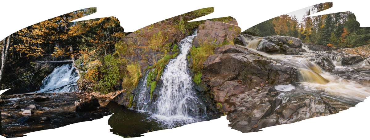
Are you a fan of waterfalls? You are in the right spot because Marquette County boasts many breathtaking falls. With the crisp air and vibrant foliage, our waterfalls have an extra touch of magic during the autumn season. Although we suggest visiting all of them, here are four waterfalls in Marquette County that you must see this fall.
Unnamed Morgan Falls
46.50737, -87.44516
Drive: 5 mi, 9 min (from downtown Marquette)
Drop: 20 ft
Source: Morgan Creek
Located just outside of the city of Marquette, Unnamed Morgan Falls is a fairly accessible 1.5 mi jaunt down a dirt/gravel road. Despite standing only 20 ft tall, it’s one of Marquette’s most popular falls as it’s as wild and rugged as it is scenic. Pair this photogenic waterfall with the U.P.’s unparalleled fall color, and it makes the perfect spot for an autumn photo op.
Directions:
-
Head west on Washington St (1.3 mi)
-
Turn south onto McClellan Ave/M-553 (2.37 mi)
-
Park at NTN South Trails Trailhead before continuing down M-553 to a dirt road closed to motorized traffic (Mt. Marquette Rd) heading West (.25 mi)
-
Walk or bike 1.2 mi on Mt. Marquette Rd
-
Turn South onto foot trail 200ft to the falls
Wright Street Falls
46.56588, -87.44576
Drive: 3.4 mi, 11 min (from downtown Marquette)
Drop: 10 ft
Source: Dead River
Among the easiest to access is Wright Street Falls. This unique spot is both urban and natural. Park in the parking lot on the right side of Wright Street and it's a short stroll across the boardwalk to reach the falls.
Directions:
- Head west on W Washington St toward N 4th St (1,145 ft)
- Turn right onto N 4th St which becomes Presque Isle Ave (1.4 mi)
- Turn left onto Wright St (2.29 mi)
- Park on the right side of Wright St, walk over the bridge and up a short path to the falls under the aqueduct (450 ft)

Warner Falls
46.43333, -87.59888
Drive: 16 mi, 22 min (from downtown Marquette)
Drop: 20 ft
Source: Warner Creek
Warner Falls is located just outside of Palmer, 20 miles southwest of Marquette on M-35. While this waterfall can be viewed from the highway, it’s best appreciated from a closer vantage point. Park your car past the guard point (fully off of the road), and follow the signage to the trails to see this small but mighty fall among autumn’s glorious orange and gold foliage.
Directions:
-
Head south on Front St (0.339 mi)
-
At the traffic circle exit west on US-41 N (0.523 mi)
-
At the next traffic circle, take the third exit onto Grove St (2.21 mi)
-
Turn left onto Co Rd 492 (4.33 mi) → Turn left on M-35 South (8.16 mi) → Park on the right side of M-35, the falls are a short trail hike west

Yellow Dog Falls
46.72863, -87.70672
Drive: 43 mi, 32 min (from downtown Marquette)
Drop: 20+ ft
Source: Yellow Dog River
The 30 minute trip from downtown Marquette to Yellow Dog Falls is worth every extra second in the car, not to mention, the drive along CR 510 and CR 550 is especially scenic in the autumn season—although 4WD is recommended. After crossing the Yellow Dog River bridge, park on the left side in the small parking area, and follow the trail about 3/4 of a mile downstream to the series of picturesque drops.
Directions:
-
Head north on N Front St (0.925 mi)
-
Turn right onto E Fair Ave (761 ft)
-
Turn left onto Pine St (0.322 mi)
-
Turn left onto N Lakeshore Blvd (0.759 mi)
-
Turn left onto Hawley St (0.650 mi)
-
Hawley becomes Big Bay Rd/Co Rd 550 (22.6 mi)
-
Turn left onto Co Rd 510 (2.6 mi)
-
After 2.6 miles you’ll turn left off the paved road onto the dirt portion of County Road 510 which heads SE. (4.1 mi)
-
Cross the Yellow Dog River. Park on the left and walk NE along the river to the falls (.35 mi). Return by the same route, or continue on 510 to see Big Pup Creek Falls, too.


